Driving in Arizona: What You May Need to Know Before Hitting the Road in Phoenix
If you’ve visited Phoenix or are a longtime resident, you may be familiar with the idyllic landscapes and wide stretches of roads. Because of its unique climate and terrain, driving in Phoenix may be more unusual than other parts of the United States. With a rising population and an increase in drivers, understanding the unique parts of driving within the city may help you navigate certain road situations.
So, whether you’re commuting to work or just making a grocery run, here’s what you may need to know about driving in Phoenix, Phoenix traffic conditions, and how Access Insurance Agency of Arizona, LLC (Access Auto) can help you find auto insurance coverage that works for you.
What makes driving in Phoenix unique?
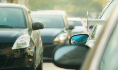
Phoenix is one of the fastest-growing metro areas in the country, which typically means more cars on the road. Unlike metropolitan areas like Chicago and New York City, Phoenix is spread out over a large area, with wide streets and long stretches between neighborhoods. Because of its sprawling nature, it’s usually common for people to drive instead of using public transportation. Due to more drivers on the highways, it may be a factor in why Phoenix has the highest car accident rate in Arizona.
Phoenix’s roads aren’t just for motorists. In more congested areas, you will typically find cyclists and pedestrians sharing the streets, especially in downtown Phoenix or college areas like Tempe. An increase in bike lanes and pedestrian zones may mean more hazards to avoid and more potential for accidents.
The mix of expansive, suburban sprawl and bustling areas around Arizona State University may make Phoenix a unique place for driving. Paying attention to your surroundings and slowing down in school zones may help prevent collisions in the city.
Phoenix driving and weather conditions
You may be familiar with Arizona’s dry heat, but you may not know how intense or perplexing Phoenix’s weather can be. Here is a brief overview of Phoenix’s weather conditions and how they may affect your driving:
Extreme heat
Summers in Phoenix can be extremely hot, with temperatures typically reaching over 100°F. Just like it can affect your body, the heat may also take a toll on your vehicle. Batteries can die faster, tires may wear out more quickly, and weak air conditioning can make even small drives uncomfortable. If your car breaks down in the heat, having roadside assistance on your auto insurance policy may help get you a professional who can provide necessary services.
Monsoons and dust storms
Those outside of the city may not know that from June 15th to September 30th, Phoenix experiences a monsoon season. This means that sudden downpours, flash floods, and massive dust storms may occur with little or no warning. In these conditions, roads can quickly become slippery, and visibility may drop to zero. If you’re caught in a storm or flood, it may be crucial to pull over if you can. A flooded road, even by a few inches, may cause your car to lose control, so it can be helpful to avoid driving through them entirely.
Due to Phoenix’s extreme weather, you may want comprehensive coverage on your insurance policy. Comprehensive coverage can help cover damages to your vehicle from certain weather-related incidents, like flooding, harsh winds, or falling debris.
Phoenix rush hour
Like most big cities, Phoenix has its share of rush-hour traffic. Weekday commutes are typically busiest from 7–9 AM and 4–6 PM. Popular routes like I-10, Loop 101, Loop 202, and US-60 may get seriously congested during these times, especially near downtown.
If you need to commute during Pheonix rush hour, it may be helpful to give yourself extra time for your ride. Additionally, you may want to consider using traffic apps that can find alternate routes when vehicles get backed up.
Defensive driving in Phoenix
Driving in Phoenix may mean dealing with sudden lane changes, tailgating, and distracted drivers. Staying alert and practicing defensive driving may help you navigate hazards while on the road.
Defensive driving typically refers to a set of tips that may help you prevent an accident. These tips include scanning the road for hazards, following speed limits, and avoiding distractions like using your cellphone. If you’ve gotten a ticket or just want to brush up on safe driving habits, you may be able to take a defensive driving course to improve your driving knowledge.
Understanding Arizona auto insurance laws
If you drive in Arizona, it may be crucial for you to understand what the state auto insurance mandates are. Arizona requires all drivers to carry minimum liability insurance, which can help pay for damages to someone else’s vehicle or third-party injuries that you cause after an accident. As of July 2025, the state liability limits are:
- $25,000 for bodily injury per person
- $50,000 for bodily injury per accident
- $15,000 for property damage
While having the state’s minimum liability coverage on your policy can meet the legal requirement, it may not be enough in a high-traffic area like Phoenix. If you're involved in a serious accident, costs may quickly exceed those minimum limits.
If you want higher liability limits or looking for a full coverage auto insurance policy, you can discuss your needs with an Access Auto agent. Our experienced, Spanish-bilingual team can help you find a policy that matches your requirements and budget.
You can call Access Auto today at 602-922-3595, visit a local store, or head to our website for a free personalized insurance quote!
Disclaimer:
This material is for general informational purposes only. Products, services, and discounts referenced herein are not available in all states or in all companies. All statements are subject to the terms, exclusions, and conditions of the applicable policy. In all instances, current policy contract language prevails. Coverage is subject to individual policyholders meeting the insurer's underwriting qualifications and state availability. Other terms, conditions and exclusions may apply.